daniel & kooper

ON A HIKE

Posts older than one year ago


Posted May 16 2010 21:55 GMT to Posterous-
This post is to thank all the angels that have graced my trail.

Trail angels are people who perform random acts of kindness for Appalachian Trail hikers.  Today, for example, some guys said they found a bunch of Cokes and Mountain Dews floating in a stream along with a box of cheese crackers.  These kinds of things, usually really simple and cheap, really boost the morale of us long-distance hikers.  Someone even just made a documentary about a few well-known angels.

First is my friend Gail, who got her cabin ready for me and my parents to stay in a few miles from Tray Mountain.  It was my first warm bed and shower since I started at Springer.

I came across a group of people at Winding Stair Gap from Trail Servants who had setup a table of goodies, cooler of drinks, Bibles, and even cookies for Kooper.  They come out every week during hiking season.

On Max Patch summit there were students from a massage school practicing on hikers.  They also let us warm up by their fire and eat veggies, bread, candy, wine, and steak!

My brother Andy met me at Trail Days to bring me back to Erwin where I left off, and then he hiked with me and took me into town to get some supplies.

But the ultimate trail angels so far have been my parents.  I'm not sure I could of done this hike without them.  Half of my gear I'm using was theirs.  They brought me food and supplies on multiple occasions.  My dad came up to Fontana Dam to pick up my dog Kooper, then they returned him a week later in Hot Springs.  They stayed a few days in Hot Springs, shuttling me back to town after a full day of hiking.  Then they drove me way up to Damascus for Trail Days.  They truly deserve their trail angel wings.
• update... a guy just picked up a meal for me from KFC. I asked him how much I owed him and he said "don't worry about it, trail magic"

YouTube
Posted May 16 2010 20:35 GMT to YouTube-
I enjoy the sunset and view while he enjoys the frisbee and grass.
2010-05-13

YouTube
Posted May 16 2010 19:42 GMT to YouTube-
Really strong winds up there. May 8th 2010

Posted May 16 2010 17:06 GMT to Flickr-
My little bro joined me for an overnight hike
• I love this picture!
Posted May 16 2010 16:29 GMT to Twitter at view on map-
• Hey Daniel - I am loving following this - and I am living vicariously through you - What a cool thing to do...the experience of a lifetime! Still hoping to arrange meeting you when you get to New England! Safe travel! Love, Lauren

YouTube
Posted May 14 2010 21:32 GMT to YouTube-
Walking across... without Kooper (dogs not allowed in the Smokies).
2010-05-03
• Hey Daniel! I like just figured out how to comment. All you have to do is press the word "comment". Okay, just wanted to say- I thought it was hard walking a mile. I can't believe this. This is so awesome. We all miss you down here. Maybe during the summer I could fly up & walk with you! Haha! Every week at Ground Zero we talk about you, and I am always keeping you in my prayers! I was so excited to show everyine at school the onahike website!
• Thanks Abby! That would be cool if you could walk with me! (I won't make you go 20 miles :P )

Posted May 14 2010 03:46 GMT to Flickr at view on map-
• What a great picture!!!!

Posted May 13 2010 00:12 GMT to Brightkite at view on map-
24 S Andrews Ave, Hot Springs, NC, United States

Posted May 12 2010 15:26 GMT to Flickr-
nom nom nom

Posted May 11 2010 14:26 GMT to Brightkite at view on map-
645 Viking Mountain Road & Viking Mtn. Rd., GreenEville, TN, United States
• Welcome back Kooper! We all missed you!

Posted May 10 2010 20:02 GMT to Posterous-

(this post has a lot of images, it may be best if you view it here)

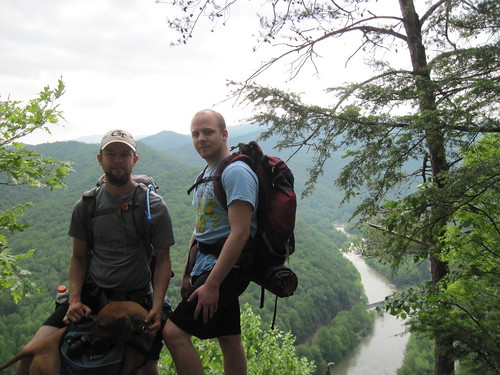
This weekend was full of so much win, I decided to just cram it all into a single post. It all started with leaving the the Great Smoky Mountains National Park. The Smokies were great (the second half anyways) but I was feeling tired after multiple 18+ mile days.  I decided to spend Friday night at Standing Bear Farm hostel, right off the trail after you pass under I-40.

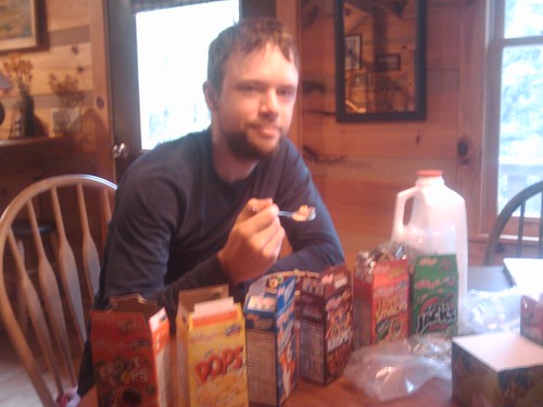
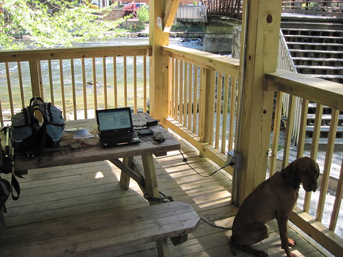
This place is like my dream home.  A creek runs through the middle, and it has a shack for everything.  A shack for eating, a shack for laundry (old school washboards), and a shack for internet.  They even have shack full of food, drink, and small hiking supplies.  You grab what you want whenever and tally it up on an envelope, then cash out when you leave.  A frozen pizza ($10) was what exactly what I needed.  Curtis, the owner(?), even drove us down to the gas station for a beer run.

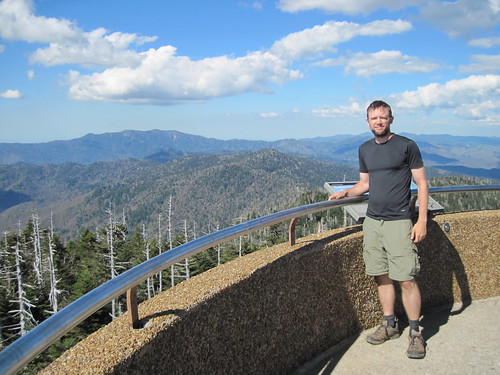
I got a late start Saturday morning, but the trail was nice and smooth so I still went about 16 miles.  I crested a cleared hill and saw a rocketship looking thing, with a great view of the mountain range behind me.  It is an Air Traffic Control VOR station. Mom says these are how planes know their position, but GPS is quickly replacing the need for these stations.

Soon after that I got to the the highlight of my hike so far; Max Patch Summit.  This place is incredible.  It's a huge grassy bald with a dramatic 360 degree view of the surrounding hills.  There were a bunch of people on top.  Picnics, kids paying tag, and it seemed that everyone had their dog but me (Kooper would have loved it!).  This picture doesn't capture it, hopefully I can upload my videos soon.

I thought to myself that it would be a great spot to watch the sunset, but I continued on about two miles to the Roaring Fork shelter.  After cooking dinner and talking to a group of guys in a discipleship program (similar to YWAM I think) that has them living together for months in an wilderness environment (wish I could remember the name, started with an N), I settled down in my sleeping bag.  Then suddenly two of the guys I had been hiking with through the Smokies came running into camp, saying there were cute girls on the hill... giving masssages!  Everyone thought they were crazy, but I put on my warmer clothes and joined them since I wanted to see the sun set anyways.  I ran to the top just as the sun was setting and it was indeed spectaclar.

Then began probably the best night ever on the AT.  Sure enough, there were girls giving massages on the hill.  They were students from a massage school in Asheville and had a big tent setup with a chair in it.  They thought it would be fun to practice on thru-hikers, and they were right.  We got cozy around their fire, when they offered us food!  Cucumbers, peppers, homemade bread, hummus, Starbursts, sangria, and.... STEAK.  We hung out with them for a couple hours until we left them in the now-freezing night temperature. (I lost my headlamp somehow during the night, so running back to the shelter was a little difficult).

When I woke up, the Starburst wrappers in my pocket were my only proof that the night wasn't just a dream.  It was freezing in the morning so I stuffed my pack and quickly got moving.  Another pleasant hike all the way into the first true trail town of Hot Springs, NC (the trail goes right down the main street).

I stayed the night in Elmer Hall's Sunnybank Inn. Built in 1875, this victorian house full of antique furniture and decorations is overflowing with character.  Elmer, the owner since 1978, cooks vegetarian meals for his guests.  After having an amazing delicious (and healthy) dinner, I immediately signed up for breakfast too.  I would like to link to more info about Sunnybank, but Elmer apparently likes to keep things simple so it's difficult to find any info about it.  Here is a good article though: Room at the Inn.

So that concludes my awesome weekend on the AT.  I am currently sitting in the Hot Springs library, using their free wifi.  This is my first "zero-day" where I do no hiking at all.  My parents will be here in a few hours to return my dog Kooper (dogs are not allowed in the Smokies).  Can't wait to see them!  I think I hike better without Kooper, but hiking with him is a lot of fun even if it does complicate things.

Next weekend?  I hope to be at Trail Days

• Great post!

Posted May 09 2010 22:05 GMT to Brightkite at view on map-
NC, United States
• You are making great progress!

Posted May 07 2010 21:22 GMT to Brightkite at view on map-
Hartford, TN, United States
• You are awesome!!!
• hey bro. nice work on all this - listened to your posts on the map. Didnt even know that could be done. Ill keep following as u go.

Posted May 05 2010 23:50 GMT to Flickr-
A spiral ramp goes up to a nice view.

Posted May 05 2010 15:48 GMT to TrailPhone at view on map-
• I never hear people mention bringing bug spray. Are they not a problem?
• Was only a problem that one day, haven't been bit since. Supposedly certain parts of the trail futher up in the summer the flies and mosquitoes can get really bad.

Posted May 03 2010 20:04 GMT to Posterous-

(I wrote this up way back in GA, but just now got around to posting it.  Since then I have moved about a day ahead of these fine folks)

The weather forcast showed a thunderstorm was coming, so I decided to stay in Hiawassee.  I didn't really want to since I just restocked and got clean a few days before.  I hiked a few miles to Dick's Creek Gap and got a shuttle to the Hiawassee Inn along with four other hikers: Mike, Krazy Fox, Bump, and Radar.

I split a room with Radar, who has hiked the AT for many years .  He also carries a netbook and a GPS for his photos and an occasional post.  His trailname is "Radar" because he knows what the weather will be thanks to his gadgets.  Check out his Trail Journal and photos.

It's been really great hanging out with these people.  Even though we are mostly strangers, we still seem to form some kind of bond through the trail.  Our ages and backgrounds are very different, but none of that seems to matter.  The trail really breaks things down to the core building blocks of community.  If our little group splits up, which it inevitably will, then new ones will form.

Each shelter usually has a notebook, so even if we part ways, I can always look forward to reading a note left by an old hiking partner (or leave one for them).


Posted May 03 2010 19:48 GMT to TrailPhone at view on map-
• Remember how you chased that skunk around in San Francisco??? Please don't do that with the rattle snakes :-) hehehe...love you brother!

Posted May 02 2010 22:05 GMT to Flickr at view on map-
• They say that they don't want to mess with you, hence the rattle... but they can also strike twice their length in distance? Be safe.

Posted May 02 2010 18:02 GMT to Flickr-
Was right next to the trail. Didn't see it until it rattled at me a few feet away. It was huge!

Posted Apr 30 2010 22:02 GMT to Flickr-
power, shade, cool breeze, wifi, and ice cream. doesn't get any better

Posted Apr 30 2010 21:21 GMT to Posterous-

Grass is hard to come by on the trail. Sure there is sporadic patch lining the path, but you may go weeks without seeing an open field.  It's a long brown tunnel, with no room to throw frisbee.

That's why when I came across Siler's Bald, I was so amazed.  A huge meadow, with deep green grass that climbs a sloping hill to an amazing view.  Kooper and I looked at each other and I think we were both thinking "frisbee".  Finally, virtually unlimited space to run and fling a flying disc.  I hesitated, it was getting late and I still had many miles to go.  I decided to go for it.  I took off my bag, emptied my pockets, and started sprinting to the top singing "The Hills Are Alive".

4565895781_2339c6e55d.jpg

When I came back down, and began to pick up my stuff, I first noticed the Bible I put down when I emptied my pockets (The one given to me by Trail Angels earlier that day).  I felt a rush of joy overtake me.  I didn't have a relevation or an epiphany or anything, just pure joy, bringing me to tears.  Truly a spiritual moment.  One that provided the lift I needed and reminded me of why I am on this hike.  One known as "Trail Magic".

Where/what is your Siler's Bald?  If you are stuck in a tunnel, try racing up the hill.  Forget your constraints for once.  Grab a frisbee and let it fly.

• Awesome man, I had a feeling you'd have some of those kinds of moments out there. Enjoy every minute of it... and stay safe. :)

YouTube
Posted Apr 30 2010 20:48 GMT to YouTube-
Throwing frisbee atop Siler Bald, NC Our first open field since we started.
2010-04-28

YouTube
Posted Apr 30 2010 20:45 GMT to YouTube-
Full panoramic view of the North Carolina mountains atop a grassy bald.
[view mobile-site]
My Progress
2178 miles
2178 *estimated based on the location of my last post
Hike for Abby
$5445