daniel & kooper

ON A HIKE

Posts older than one year ago


Posted Jul 14 2010 19:24 GMT to Flickr at view on map-
Lots of rain the past few days.

Posted Jul 09 2010 10:59 GMT to Posterous-

Maryland and Pennsylvania (first half anyways) are probably the easiest sections of the Appalachian Trail.  The downside is that its at low altitude and currently in a record-setting heat wave.  Good thing there have been ways to deal with the heat this week:

Sunday : Dip hand-towel in cold spring water to lay on chest at night.
Monday:  Take 3 hour lunch break at http://www.freestatehiker.com
Hike into the not-so-cool of the night to meet a friend who takes you to a hotel (thanks Tyler!)
Tuesday:  Eat Chick-Fil-A Icedream before getting back on the trail.
Jump into the Caledonia State Park pool right before it closes.
Wednesday: Hike to Pine Grove Furnace State Park to eat a half-gallon of ice cream to celebrate completing half the AT.
(I finished a half gallon of Cherry Jubilee in under 25 minutes, all 2400 calories)
Spend the rest of the evening at the park's beach.
Thursday: Hike to Boiling Springs, PA and get in the mini water park or in the very cold spring water (it boils by looks, not temperature)
Friday (today): my plan was to do a short hike up to US 11 to spend the day in a hotel room... but they are all booked due to some auto show.
So plan B:  Hike 30 miles to the town of Duncannon for free food and a shower, or if I'm lucky, a night or two at The Doyle.

I know, 30 miles doesn't sound like a good idea in the heat, but the terrain is flat (walking through farm land), I can take a good long break every 10 miles, I'm starting really early in the morning, and this section sucks so I just want to get it over with.  Wish me luck and rain!

• Take it easy, dude! 30 miles is not easy, but be sure you have plenty of water! Did you get my message/question? Where should we mail the package???? Duncannon seems too late....where next?
Posted Jul 07 2010 19:11 GMT to Twitter-
• eeeeek! So coool! You hav made it way farther than I thought u would.... Just being honest ;-) U r a machine!!!!
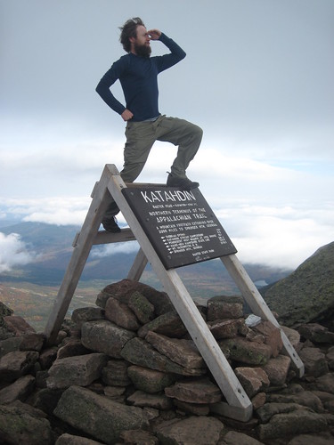
• 0.0115 to be exact. That extra 0.0015 makes all the difference. And it was all pain.

Posted Jul 05 2010 17:19 GMT to Posterous-

Today I passed by the first Washington Monument, built July 4th, 1827 by the folks in Boonsboro, MD.  An interesting contrast to the many Civil War battlefields I saw yesterday.  One Declaration of Independence celebrated; one declaration of independence denied.

The Appalachian Trail continues the American quest for independence.  I have never felt more free than here in the woods.  Free from all the traps of society today: expectations, material possessions, and the need to perform.  I don't know if this will change things when I get home, but I know I have a different perspective on many things now.

I'm writing this from my tent on Annapolis Rock. I hope to see some fireworks from the great view up here.  Not a big deal if I don't, as its hard to beat this sunset.  Happy Independence Day!

Update: Didn't have a signal to post this last night.  Saw a ton of fireworks going up all over the valley, but couldn't see the ones close by, as Haggarstown was blocked by the mountain jutting out.  Blackrock Cliff would have been better, but I didn't want to walk a mile in the dark.


Posted Jul 01 2010 00:00 GMT to Flickr at view on map-
Near Blackburn Trail Center/Hiker Hostel
• So you're saying that you have walked 500 miles, and you have walked 500 more? Da d-da da!

Posted Jun 28 2010 18:55 GMT to Brightkite at view on map-
United States
• you're my hero. Love reading about your hike through the AT!
Posted Jun 27 2010 19:39 GMT to Twitter at view on map-
• It was fun Sims, thanks for having us.
• Had a great time. You are a beast.

Posted Jun 24 2010 23:14 GMT to Flickr at view on map-
Wonderful day of hiking. They did great!
• You totally need to update your Twitter avatar to show off the beard.
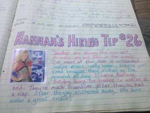
• They get the awesome views and Tyler and I get the bears, snakes and ticks. :)

Posted Jun 20 2010 03:10 GMT to Flickr at view on map-
I can see in the back there is an old convertible VW Bug next to a Carrera GT *drools on the glass door*

YouTube
Posted Jun 20 2010 01:28 GMT to YouTube-
Perfect way to cool off after a 20 mile day. These kids gave me a ride into Glasgow too.

Posted Jun 20 2010 01:09 GMT to Brightkite at view on map-
1219 West Broad Street, Waynesboro, VA, United States
Posted Jun 19 2010 21:25 GMT to Twitter at view on map-
• Got a shower at a nearby church that houses hikers. Too bad they don't allow dogs
• If you have time, eat at Weezey's in Waynesboro. It's a diner with awesome breakfasts & great prices... you won't be disappointed!

Posted Jun 18 2010 05:10 GMT to Flickr at view on map-
Spy Rock
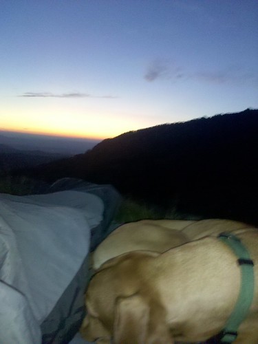
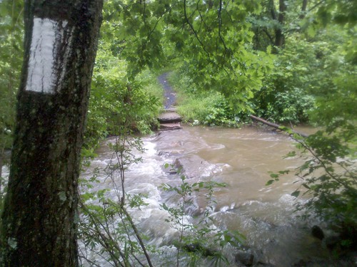
• It actually got really cold, didn't get much sleep. But the stars were worth it. The Google Sky Map app for Android came in handy

YouTube
Posted Jun 17 2010 22:50 GMT to YouTube-
Camping just below. I should get to see sunset AND sunrise.

Posted Jun 16 2010 01:44 GMT to Brightkite at view on map-
VA, United States
• Cool town, they even have a shelter in town for hikers since the motel closed.
[view mobile-site]
My Progress
2178 miles
2178 *estimated based on the location of my last post
Hike for Abby
$5445